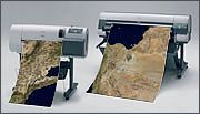
Large scale printing of satellite images
and maps
We print for you on modern large scale printers high-quality prints of
satellite images, maps and other GIS-data. Prints up to DIN A0 and more
are possible, on demand also laminated.

We care for an optimal image preprocessing:
• Digital image enhancement
• Integration of vector data
• Layout with legend and overview map
• Grid (custom projections and datums)
• Integration of custom GPS-Data (tracks, waypoints) or Atlogis
vector-data (e.g. citynames)
Please contact
us for further information.
|