Home
Contact
Satellite images
15m LANDSAT 7 mosaic
30m LANDSAT 5 mosaic
120 1920m Landsat
15m ASTER
Satellite image maps
Digital maps
Shaded relief maps
Topographic maps
Vector maps
World-vector-map-set
Tunisia vector-map
Services
GIS / Remote Sensing
Web-GIS
3D Visualization
GIS-Server/Data Hosting
Large scale printing
...under Construction
Please come back later.
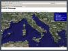
ATLOGIS Maps
Online-viewer for our satellite imagery and maps.
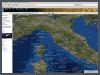
ATLOGIS MetaMaps
See Atlogis, Google, MSN and Yahoo Maps in one single viewer.
» Print
» Top
» Back